Figures & data
Figure 1. Hobet-21 surface mine complex. Base image for the top image is the NAIP orthophotography acquired on 14 July 2011. Base image for the bottom image is the RapidEye satellite imagery (© (2013) BlackBridge S.àr.l. All rights reserved) acquired on 1 August 2011. The depicted mine extent is based on the surface mining permit obtained from WVDEP. The map is projected in NAD83 UTM Zone 17 N.
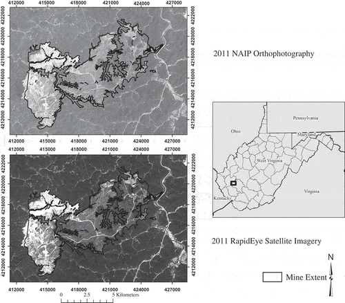
Table 1. Characteristics of NAIP orthophotography and RapidEye satellite imagery used.
Table 2. Land cover class definitions.
Table 3. Number of training polygons, areas (ha) of training polygons, and number of randomly selected training pixels manually interpreted for each land cover class based on manual interpretation of multiple sources.
Table 4. Comparison of map accuracy for NAIP and RapidEye.
Figure 2. Relative importance of predictor variables for NAIP and RapidEye at provided cell size as estimated by the oob mean decrease in accuracy by RF.
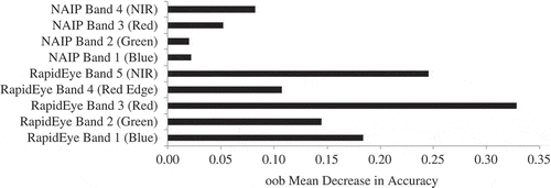
Figure 3. Relative importance of predictor variables for NAIP and RapidEye at common cell size (6.5 m) as estimated by the oob mean decrease in accuracy by RF.
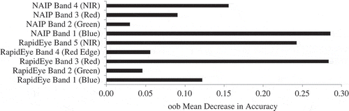
Figure 4. Relative importance of predictor variables for leaf-on and leaf-off RapidEye bands as estimated by the oob mean decrease in accuracy by RF.
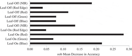
Table 5. Error matrix for NAIP (6.5 m cell size, 8-bit) classification using RF.
Table 6. Error matrix for leaf-on RapidEye (6.5 m cell size, 12-bit) classification using RF.
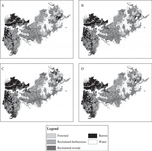
Figure 5. Land cover classification using (A) NAIP orthophotography (6.5 m) and SVM, (B) NAIP orthophotography (6.5 m) and RF, (C) RapidEye (6.5 m) and SVM, (D) RapidEye (6.5 m) and RF.