Figures & data
Figure 1. Map of the study area with the burn scar and field sampling locations.
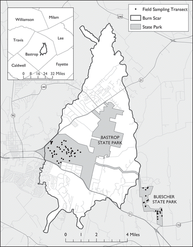
Table 1. Landsat imagery (path 27, row 39).
Table 2. Mean NDVI: burned plot and control plot.
Figure 2. Mean NDVI for the burned and control plots and monthly precipitation totals (NOAA Citation2014), 2006–2014. Burned plot NDVI initially decreased by 35% following the fire, but exhibited rapid recovery levels in the ensuing years.
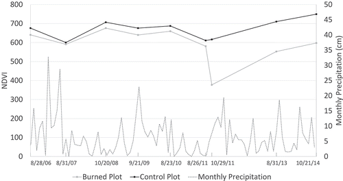
Figure 3. Burn severity map based on pre- and postfire dNBR classification. Heavily burned areas were most prevalent (32.6%), followed by lightly burned (28.5%), moderately burned (22.0%), and unburned/scorched areas (16.9%).
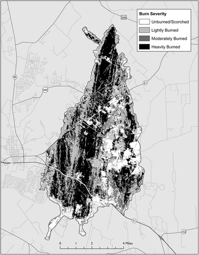
Table 3. Mean NDVI by burn severity class.
Figure 4. Mean NDVI by burn severity class, 2006–2014. Unburned/scorched and lightly burned areas demonstrated consistently positive post-wildfire NDVI gains, in contrast to moderately and heavily burned forest that lost NDVI in the third post-wildfire year.
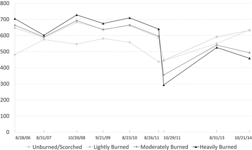
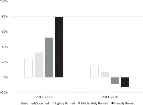
Figure 5. Postfire change in NDVI by burn severity class, 2011–2013 and 2013–2014. NDVI growth initially favored more heavily burned areas between 2011 and 2013, but the relationship reversed in the following year.