
Figures & data
Figure 1. Gaussian synthetic surface.
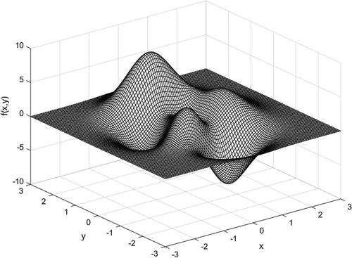
Table 1. Accuracy comparison between MQ and MQ-T under different error distributions.
Figure 2. Error surfaces of (a) MQ and (b) MQ-T for Case 1.
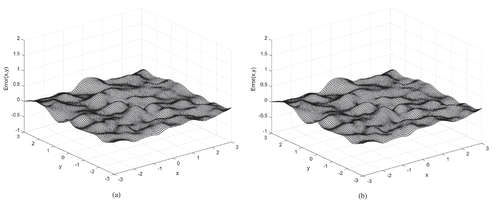
Figure 3. Error surfaces of (a) MQ and (b) MQ-T for Case 3.
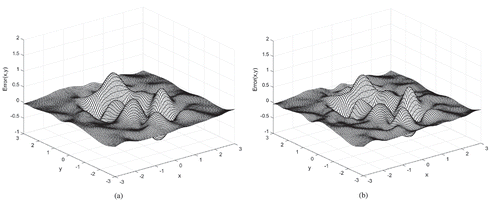
Figure 4. Error surfaces of (a) MQ and (b) MQ-T for Case 5.
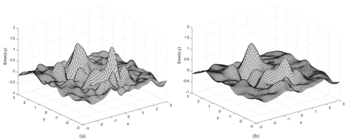
Figure 5. Distribution of the 500 control points in the study site.
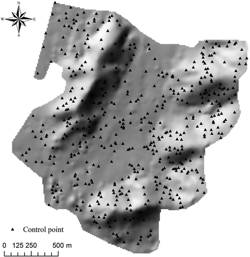
Table 2. Relationship between the number of sample points and sample interval (SI).
Table 3. Optimal parameters of IDW, ANUDEM, MQ, and MQ-T under different SIs.
Figure 6. Kriging semivariograms fitted with different sample point groups. (a) Semivariogram fitted with 2100 points (i.e., SI = 40 m), (b) semivariogram fitted with 2742 points (i.e., SI = 35 m), (c) semivariogram fitted with 3721 points (i.e., SI = 30 m), and (d) semivariogram fitted with 5394 points (i.e., SI = 25 m).
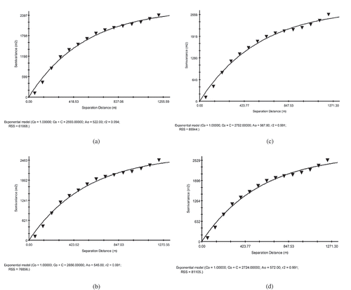
Table 4. RMSEs of all interpolation methods for 10-m-resolution DEM construction under different SIs in the real-world example (unit: m).
Table 5. RMSEs of all interpolation methods for different resolution DEM construction under 30-m SI in the real-world example (unit: m).
Figure 7. Hillshades of (a) IDW, (b) OK, (c) ANUDEM, (d) MQ, and (e) MQ-T for 10-m-resolution DEMs constructed with 35-m SI. Isolated pits and artificial mounds are flagged by the rectangles in the maps of OK and MQ. Omitted subtle terrain features are marked by the circles in the map of ANUDEM.
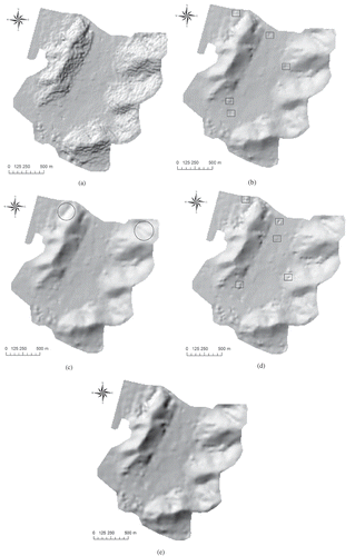
Table 6. Computational costs of all methods for constructing 10-m-resolution DEMs with 2100 sample points (i.e., SI = 40 m).
Table 7. Correlation coefficients between interpolation errors and terrain slopes for DEMs under 30-m SI.