
Figures & data
Figure 1. Geographical location of Mumbai, and map of census sections in Mumbai.Note: Numbers on the map represent the ID of census sections; Insets A and B provide magnified views of census sections.
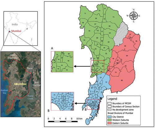
Figure 2. Methodological framework adopted for the study.Note: The numbers represent the ID of the census section; Insets A and B provide magnified views of census sections.
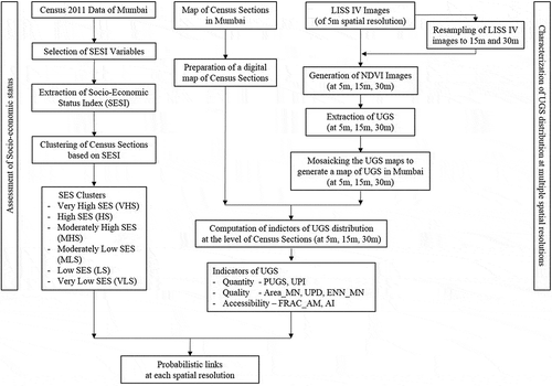
Table 1. Description of the census variables used for computing SESI.
Table 2. Description of the urban green space distribution indictors used in the study.
Table 3. Descriptive statistics of the socio-economic status clusters.
Figure 3. Socio-economic status clusters of census sections in Mumbai.
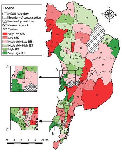
Figure 4. Map of urban green spaces in Mumbai extracted from satellite images of 5m spatial resolution.
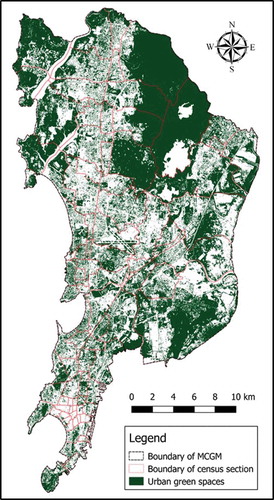
Table 4. Urban green space distribution indicators of census section 1 at different spatial resolutions.
Figure 5. Scene covering Horniman Circle Garden, Mumbai.a) Google Earth image; b) Standard false colour composite of LISS IV image (5m); c) UGS map at 5m resolution; d) UGS map at 15m resolution, and e) UGS map at 30m resolution. Note: In panels (c) to (e), the urban green spaces are shown in green.
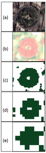
Table 5. Multinomial Logistic Regression model for socio-economic status and the urban green spaces indicators derived at 5m spatial resolution.
Table 6. Multinomial Logistic Regression model for socio-economic status and the urban green spaces indicators derived at 15m spatial resolution.
Table 7. Multinomial Logistic Regression model for socio-economic status and the urban green spaces indicators derived at 30m spatial resolution.