
Figures & data
Figure 1. LiDAR point cloud of highway segments.
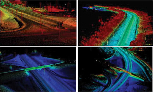
Figure 2. Applications of mobile laser scanning in transportation [Adopted from (Olsen et al. Citation2013)].
![Figure 2. Applications of mobile laser scanning in transportation [Adopted from (Olsen et al. Citation2013)].](/cms/asset/2fc4226a-1b25-44f8-801b-9b1f99817699/tgrs_a_1581475_f0002_oc.jpg)
Figure 3. Transportation features extracted from LiDAR in previous work.
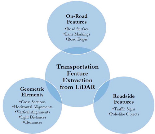
Table 1. A summary of previous studies that attempted the extraction of road surface, lane marking, and road edges from LiDAR.
Table 2. A summary of previous studies that attempted the extraction of traffic sign information from LiDAR.
Figure 4. Mapped sign clusters extracted from a LiDAR scan of one of the test highways in Gargoum et al. (Citation2017).
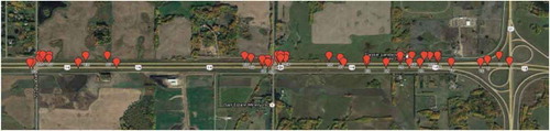
Table 3. A summary of previous studies that attempted the extraction of other roadside objects from LiDAR.
Table 4. A summary of previous studies that attempted the extraction of road alignment information from LiDAR.
Table 5. A summary of previous studies that attempted assessing sight distances using LiDAR.
Table 6. A summary of previous studies that attempted clearance assessment using LiDAR.
Table 7. Common techniques used in previous research to process LiDAR point clouds for transportation applications.