
Figures & data
Figure 1. The overall workflow of the forest AGB estimation. Note that AGB and DBH represent aboveground biomass and diameter at breast height.
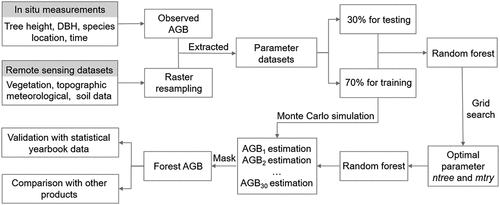
Figure 2. The spatial distribution of validation samples and training samples in seven vegetation zones with a corresponding photo (All photos come from the Internet).
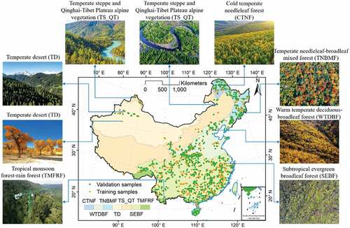
Table 1. Count of training and validation ground measurements by vegetation zone.
Table 2. Statistics for 17 variables used in this study.
Table 3. Major characteristics of forest AGB maps for comparison.
Figure 3. Frequency distribution of observed AGB values in different vegetation zones of China. μ, σ, and n represents the average, standard deviation, and the sample size of observed AGB, respectively.
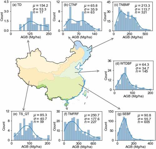
Figure 4. (a) Spatial pattern of forest AGB of China. (b) the percentage of forest AGB at different levels.
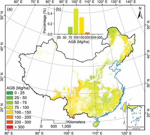
Figure 5. The spatial pattern of AGB uncertainty of China. AGB uncertainty is the standard deviation of the 30 AGB estimates.
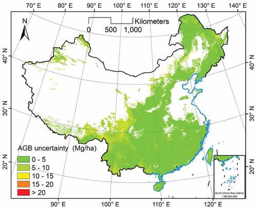
Figure 6. The statistics of AGB estimates by (a) administrative divisions (i.e. provinces, autonomous regions, or special administrative districts) and (b) vegetation zones in China.
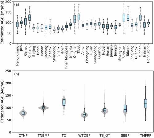
Figure 7. (a) Predicted AGB versus observed AGB; (b) Rank the importance of variables by %IncMSE and IncNodePurity. Note that R2, RMSE, Bias, SD represent the coefficient of determination, root mean square error, mean bias, and standard deviation. FCH, NDVI, C/N, SOC, SM, STN, Pmean, Pseason, PET, Tmean, Tseason, and VPD represent forest canopy height, normalized difference vegetation index, soil C: N mass ratios, soil organic carbon, soil moisture, soil total nitrogen density, average precipitation per year, precipitation seasonality, mean annual potential evapotranspiration, average temperature per year (Tmean), temperature seasonality (Tseason), and maximum annual vapor pressure deficit.
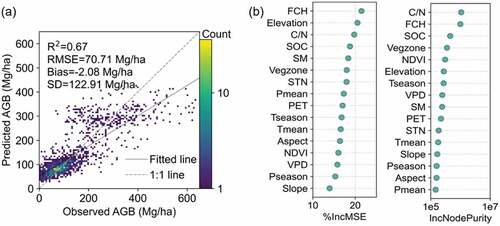
Figure 8. Comparisons between province-level statistical AGB and total AGB values collected from China’s Forestry and Grassland Statistical Yearbook 2018 with our estimated values. (a) AGB in 31 provinces. (b) AGB in 28 provinces. (C) Total AGB in 31 provinces.
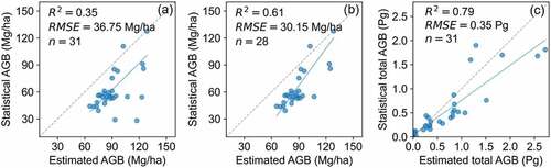
Figure 9. Forest AGB differences between our map and other maps for the year 2019. μ: average of the AGB difference; σ: standard deviation of the AGB difference.
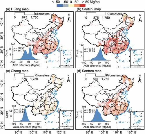
Figure 10. Spatial details of AGB estimates of different AGB maps in three sites.
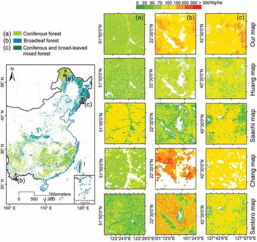
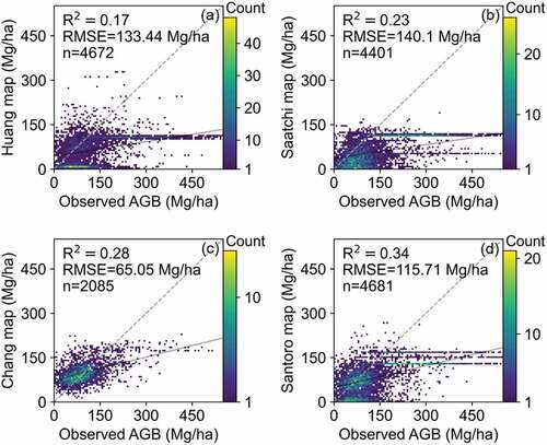
Figure 11. Observed AGB collected in this study versus the AGB from other products (a)-(d).
Supplemental Material
Download (254.7 KB)Data availability statement
The generated high-resolution forest AGB map will be made available through the web (www.3decology.org) upon the decision of acceptance for publication.