
Figures & data
Figure 1. Study area (Peloponnese) with landslide events.
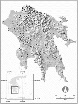
Figure 2. Data layers – predictor variables.
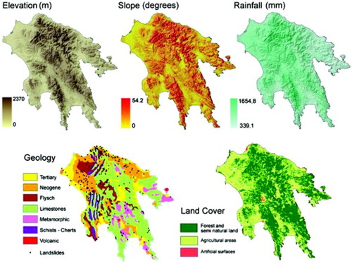
Table 1. Data layers of the spatial database representing landslide influencing factors.
Table 2. Global Logistic Regression parameter estimates and model diagnostics.
Table 3. Geographically Weighted Logistic Regression parameter estimates and model diagnostics.
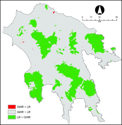
Figure 3. Differences of landslide susceptibility estimations between the GWLR and the global Logistic Regression.
Supplemental material