Figures & data
Figure 1. An overview of the general workflow for generating playground spatial integration mapping.
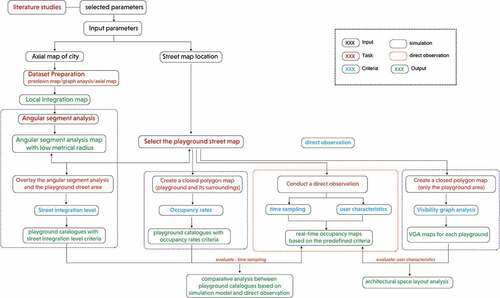
Figure 2. Dataset collection of 10 selected playgrounds in Delft.
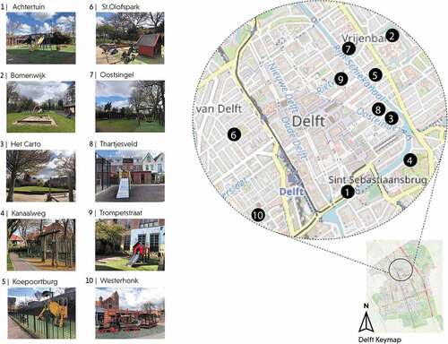
Figure 3. Street integration map of delft city center.
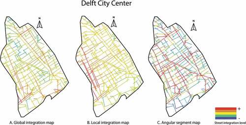
Figure 4. Playground catalogues based on street integration analysis.
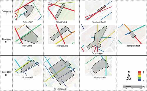
Figure 5. Playground catalogues based on agent-based model.
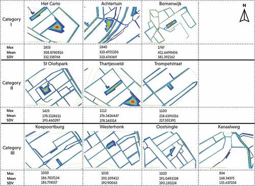
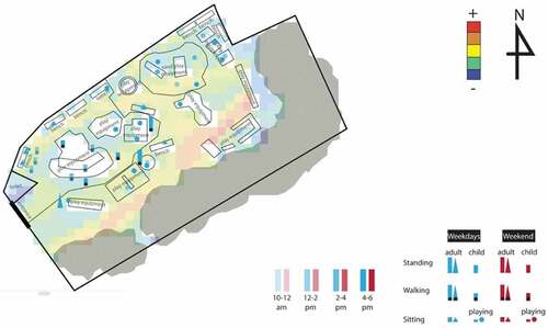
Figure 6. Occupancy map of playgrounds based on on-site observations.
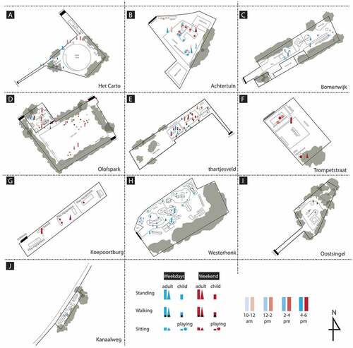
Figure 7. The layout and VGA of playground Achtertuin.
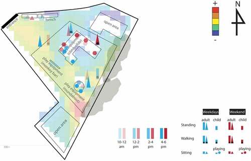
Figure 8. The layout and VGA of playground Olofspark.
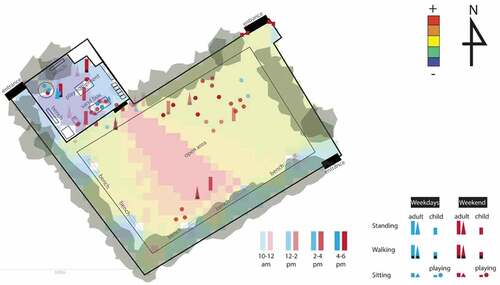
Figure 9. The layout and VGA of playground Westerhonk.