Figures & data
Figure 1. General keymap of Neyyar sub-watershed tells about the location and its pathway of roads, Neyyar river, and settlements.
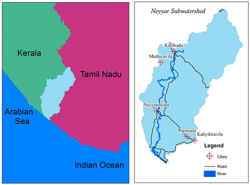
Table 1. Stream order, streams number, and bifurcation ratios in Neyyar sub-watershed.
Table 2. Stream length and stream length ratio in Neyyar sub-watershed.
Table 3. Formulas, reference, and result of drainage network in Neyyar sub-watershed.
Table 4. Stream order, stream order wise mean area in Neyyar sub-watershed.
Table 5. Formulas, reference, and result of basin geometry in Neyyar sub-watershed.
Table 6. Formulas, reference, and result of drainage texture analysis in Neyyar sub-watershed.
Table 7. Different stages of hypsometric estimation.
Figure 2. Hypsometric curve defines the relief characteristics to determine the soil erosion.
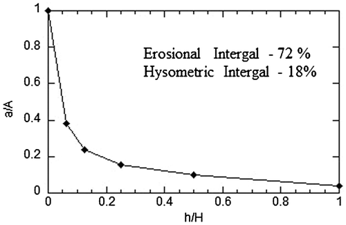
Table 8. Formulas, reference, and result of relief characteristics in Neyyar sub-watershed.
Figure 3. Aster G-DEM of Neyyar sub-watershed gives the detailed topography which deals with the relief characteristics.
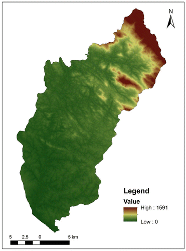
Figure 4. Neyyar sub-watershed holds up to seven stream orders classified through the Strahler method, determine the drainage network system.
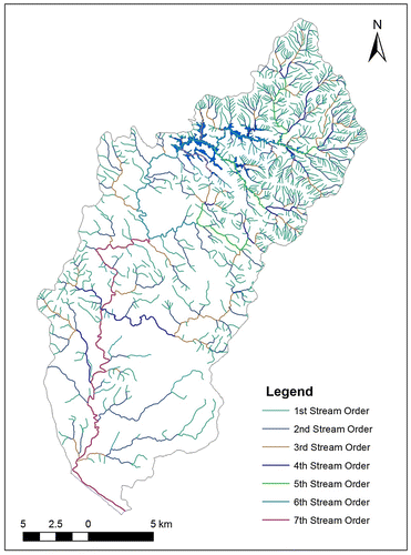
Figure 5. Drainage networks of Neyyar sub-watershed deals with the grid-based methods to understand the volume of water holding capacity.
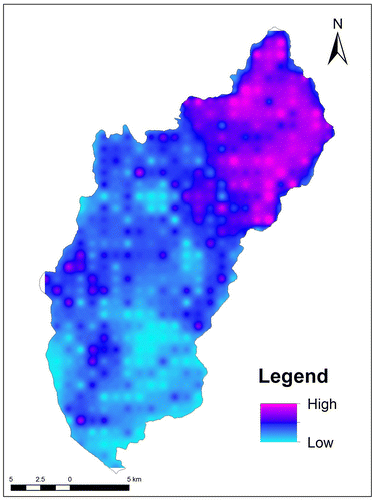
Figure 6. Geomorphology of Neyyar sub-watershed using Landsat imagery interprets the different morphology condition from the young to mature stage of River.
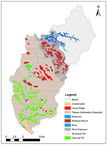
Figure 7. Landuse/landcover of Neyyar sub-watershed using Landsat imagery interprets the NRSC level 1 Classification, to understand the natural and artificial usage in the earth surface.
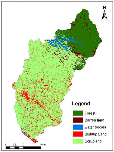
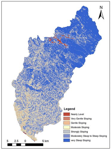
Figure 8. Slope of Neyyar sub-watershed using Aster-DEM classified through IMSD level, which deals with the nearly level to very steep sloping.