Figures & data
FIGURE 1 Study areas in northern Norway. Numbers refer to , where a detailed description is given.
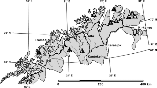
TABLE 1 Characteristics of investigated areas in northern Norway.
TABLE 2 Vegetation types with number of samples (subscript a refers to acidic samples, and subscript b to non-acidic samples).
TABLE 3 Environmental variables recorded and used for statistical analyses.
FIGURE 2 Boxplot of species densities (top) and Shannon’s diversity index (bottom) for 6 vegetation types. Whiskers indicate the 5–95% interval, outliers are shown as diamonds. Numbers of vegetation types refer to , shaded boxes indicate samples on non-acidic soil parent material.
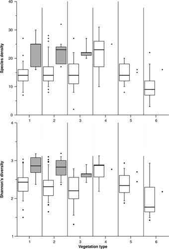
FIGURE 3 Regression tree of 232 samples using species densities and environmental variables. Shaded leaves indicate low species densities (<16), black leaves indicate high species densities (>22).
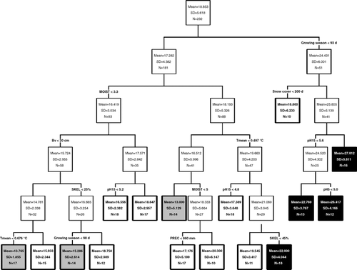
FIGURE 4 Comparison of heavily grazed samples (gray) and less grazed samples (black) with regard to species numbers and percentage coverage.
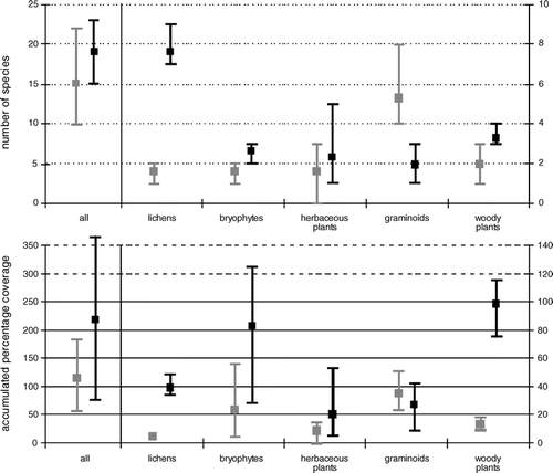
FIGURE 5 DCA scatter plot of samples. Four vegetation types (out of chionophobous communities, chionophilous communities dominated by dwarf-shrubs or graminoids, and mires) were highlighted within the scatter plot to ease orientation.
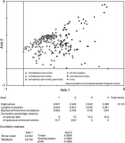
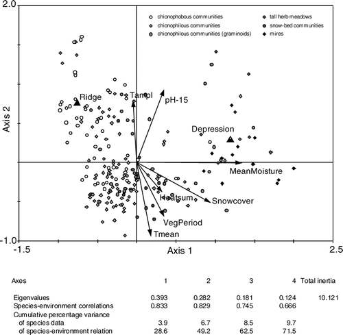
FIGURE 6 CCA biplot of samples and environmental variables.