Figures & data
FIGURE 1. Rockfall collector “Kreuzklamm”, Dammkar area. The collector is made of netting, while for most of the other collectors wire mesh was used. The width of the collector is 1 m; the rockwall above is inclined approximately 65°. A schematic diagram of the devices is on the upper left
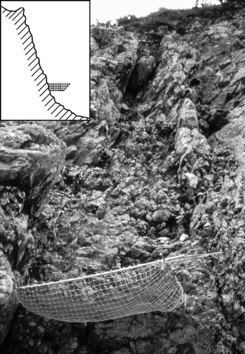
FIGURE 2. Location of the study sites “Dammkar” and “Tegelberg”
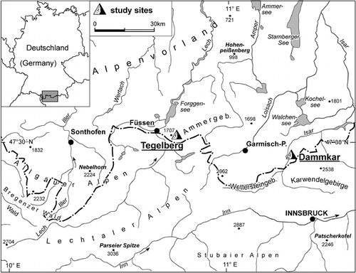
FIGURE 3. Rockfall registered at the collector “Kirchl 1”, 1995–1997. The width of the columns reflects the length of the respective service interval
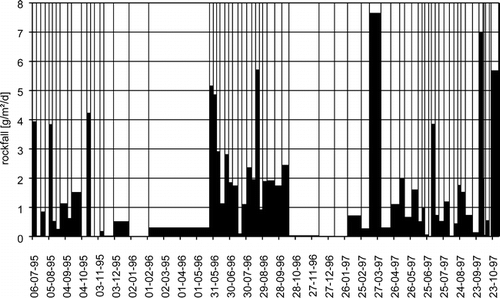
FIGURE 4. Rockfall at various test sites of the upper Dammkar area, 1995. Air temperature and precipitation measured at the meteorological station at 2200 m
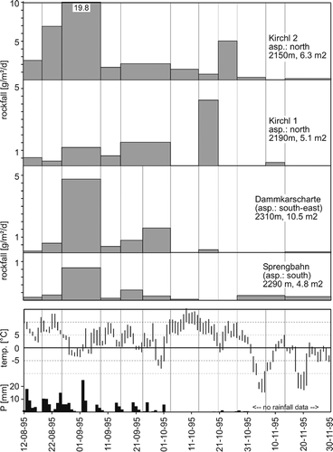
FIGURE 5. Rockfall at various test sites of the lower Dammkar area, 1997. Temperature measured at 1800 m, missing intervals interpolated from the meteorological stations at 2200 and 950 m. Precipitation measured at the Mittenwald station (950 m)
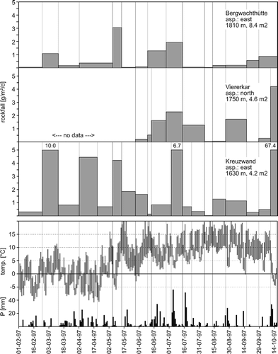
FIGURE 6. Mean removal rate of all collectors in the Tegelberg area, 2001 and 2002. Above the columns: mean temperature, minimum temperature and total amount of precipitation during the sampling intervals. “Front”: freeze-thaw activity with coincident precipitation. Inside the columns: number of test sites showing above-average rockfall (compared to total number of collectors)
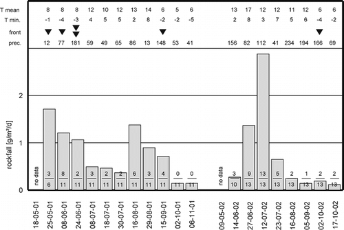
FIGURE 7. Long-term removal rates (nine years) at the test sites “Dammkarscharte” and “Kirchl 2”, Dammkar area. From 1998 to 2001, no separated summer and winter values are available
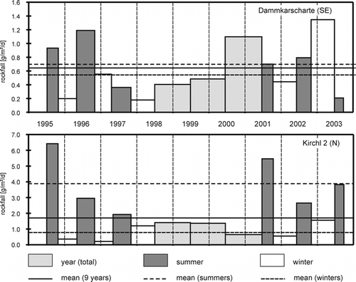
TABLE 1 Mean annual temperature and precipitation at various weather stations near the areas of investigation. Dammkar area: own measurements from 1995 to 1997, no precipitation data available for the winter months
TABLE 2 Percental distribution of the rockfall rates on different classes during various weather conditions. ↑: positive deviation (higher removal); ↓: negative deviation (lower removal); α: level of significance (chi2 test)
TABLE 3 Rates of rockwall retreat derived from measurements using netting or other kinds of rockfall collectors