Wallace, C.S.A., P. Thenkabail, J. R. Rodriguez, and M. K. Brown. 2012. “Fallow-land Algorithm Based on Neighborhood and Temporal Anomalies (FANTA) to Map Planted Versus Fallowed Croplands Using MODIS Data to Assist in Drought Studies Leading to Water and Food Security Assessments.” GIScience & Remote Sensing 54(2): 258–282. doi:10.1080/15481603.2017.1290913
When the above article was first published online, and were published with errors. The corrected figures and captions are published below:
Figure 5. Flowchart of FANTA methods.
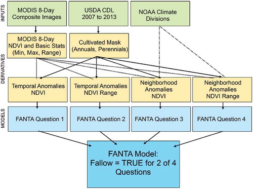
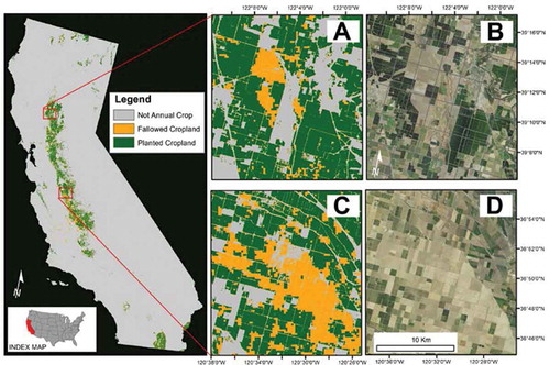
Figure 12. FANTA Model for 2014. The FANTA model for 2014 is shown in the left panel. The zoomed insets (a–d) show details of the FANTA model (a and c) with the 2014 natural color NAIP imagery on the right (b and d). NAIP imagery, produced by the USDA-FSA Aerial Photography Field office, was accessed January 2015 at: https://www.fsa.usda.gov/programs-and-services/aerial-photography/imagery-programs/naip-imagery/.
NOTE: The model shown in insets (a) and (c) of Figure 12 of the original article show FANTA results for 2015.