Figures & data
Table 1. Statement of used lidar data
Figure 1. Test area and field survey.
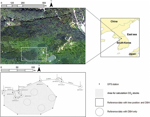
Table 2. Collected tree information by field measurements
Figure 2. Generated DTM in the process of lidar filtering: (a) the coarse DTM with 10 m resolution from step 1, (b) the DTM with 2 m resolution from step 2, (c) the fine DTM with 0.5 m resolution from step 3, (d) the final DTM.
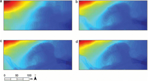
Figure 3. Derived (a) DSM and (b) CHM, which means DSM minus DTM.
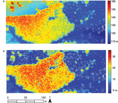
Figure 4. The flowchart of tree crown delineation algorithms.
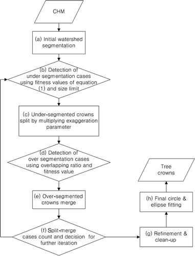
Figure 5. The tree crown evaluation in each iteration stage: (a) the first iteration stage, (b) the second iteration stage, (c) the final iteration stage. Note the change of segment within uniform point clouds.
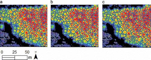
Figure 6. Derived CHM (a), final fitted tree crown using (b) ellipse and (c) circle model.
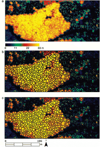
Figure 7. Tree crown fitting results in mixed forests; note the algorithms work well in mixed forest (a) as well as deciduous forest (b).
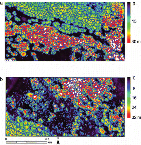
Figure 8. Comparison of the DBH–height equations with sample counts 144.
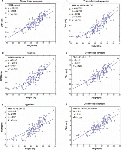
Figure 9. Procedure of CO2 calculation.
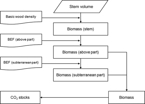
Table 3. The result of quantitative assessment of the filtering performance.
Table 4. Comparison of tree information acquired between lidar analysis and field measurements
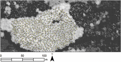
Figure 10. Estimated tree positions by lidar analysis (+) and field measurements (○) in sampling area 1.
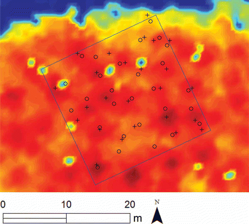
Figure 11. Estimated tree positions by lidar analysis (dark) and reference tree positions (light) produced manually.